

PhilSA Empowers Bulacan with Space Data Training for Disaster Risk Reduction
By: The Good News Pilipinas Team
|
Published on: April 30, 2025
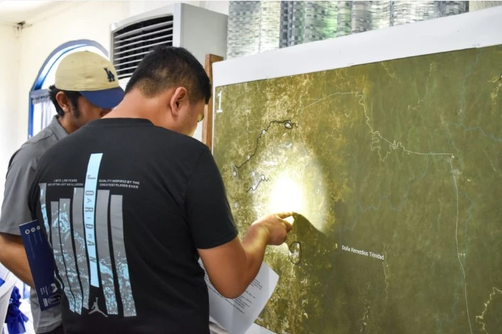
Participants identify concerns in their areas during the participatory mapping workshop. (Photo from PhilSA)
Bulacan is boosting its disaster preparedness with the help of space technology, thanks to a recent training led by the Philippine Space Agency (PhilSA). Local disaster risk reduction officers and government personnel learned how to use satellite data and geospatial tools to strengthen the province’s response to floods, droughts, and other hazards.
The Philippine Space Agency (PhilSA), in partnership with the Provincial Government of Bulacan, conducted a three-day PINAS Workshop and Training on Space Science and Technology Applications (SSTA) for Disaster Risk Reduction and Management (DRRM) from April 23 to 25, 2025, in Malolos City.
Participants from the Bulacan Provincial Disaster Risk Reduction and Management Office (PDRRMO), local government units, and provincial offices learned how to use space data to enhance disaster preparedness, response, and recovery. The training included hands-on sessions on flood mapping, drought assessment, ground motion monitoring, and remote sensing. They created flood and drought maps using both optical and radar satellite imagery.
PhilSA also distributed geospatial data packages containing land cover classification maps, satellite images, and agricultural drought outlook maps. Participants were introduced to open-source data like Sentinel-2 imagery from the Copernicus program, which they can use in local planning and disaster monitoring.
Roberts Marinas of the Department of Human Settlements and Urban Development (DHSUD) presented how SSTA supports climate change adaptation through the Climate and Disaster Risk Assessment (CDRA), which helps assess hazards and protect communities and their assets.
Technical presentations during the workshop covered drone operations, field data integration, and the importance of spatial analysis in DRRM. A participatory mapping activity allowed local stakeholders to identify environmental, agricultural, and disaster-related concerns in their areas.
“This initiative highlights the critical importance of strengthening linkages between national agencies and local governments to advance the application of SSTA in DRRM,” PhilSA stated.
Atty. Nikki Manuel Coronel, Chief of Staff representing Governor Daniel R. Fernando, said, “Science-based approaches play a critical role in deepening our understanding of the environment and enhancing the delivery of public services—especially during disasters—to ensure the safety and well-being of communities.”
Bulacan DRRM Officer Manuel M. Lukban, Jr. emphasized, “Leveraging satellite data and geospatial technologies can assist in hazard monitoring, improve risk assessments, and strengthen the province’s capacity for disaster preparedness, response, and recovery.”
This is the first of several technical workshops and consultations in Bulacan under the PINAS Project, which promotes sustainability through space-based data. Since its launch in October 2022, the project has held workshops in Iloilo, Palawan, Ilocos Region, Aklan, Mindoro, Davao, Zamboanga, Cebu, and Bataan.
Join our vibrant Good News Pilipinas community, where we celebrate the achievements of the Philippines and Filipinos worldwide! As the Philippines’ No. 1 Website for Good News and proud winners of the Gold Anvil Award and Lasallian Scholarum Award, we invite you to connect, engage, and share your inspiring stories with us. Together, let’s shine a spotlight on the stories that make every Filipino proud. Follow us on all platforms through our LinkTree. Let’s spread good news and positivity, one story at a time!